Understand water and nature.Inform the next decision.
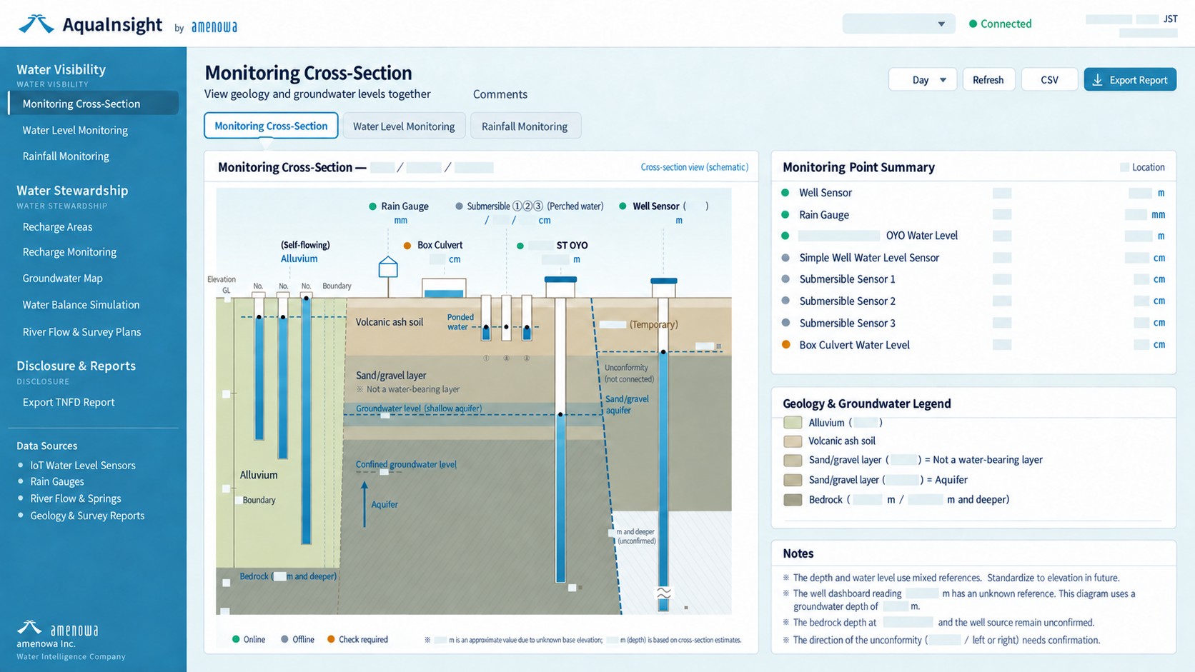
A platform that connects monitoring, surveys, topography, geology and water-use data to understand nature, guide protection and restoration, and support disclosure.
Collecting data is not an end in itself. We use it to understand water and nature and inform the next decision.
SUPPORT
AquaInsight implementation, supported from the field.
AquaInsight does more than display sensor readings. Understanding where water comes from, how it flows, and how it relates to nature and business requires field surveys, monitoring design, sensor installation and specialist information on topography and geology. Working with researchers and specialists, amenowa supports the entire implementation process, from surveys and monitoring design to data integration, analysis and the assessment of improvement measures.
Understand the fieldFIELD
MonitorMONITOR
Connect the dataUNDERSTAND
Take actionACTION
01FIELD RESEARCH
Understand the field
We investigate hydrogeology, groundwater, springs, rivers, forests, topography and geology to understand the local water cycle.
02MONITORING DESIGN
Decide what and where to measure
We design monitoring locations, sensors and IoT infrastructure to suit the project’s objectives, covering groundwater levels, rainfall, rivers and water use.
03DATA INTEGRATION
Bring separate data together
AquaInsight brings together sensor readings, existing data, topography, geology, forests and water use to provide a coherent view of water conditions.
04ACTION & REVIEW
Decide what to do next
We identify where protection is needed and which measures to take, including forest management, groundwater recharge, water abstraction, water use and green infrastructure.
Monitoring continues after implementation so that observed changes inform the next decision.
Visualization is not the end goal.
Understanding water helps us decide where to protect, where to invest and what needs to change. That is the role of AquaInsight.
CASE STUDY / RUSUTSU RESORT
Building AquaInsight from real-world fieldwork
At Rusutsu Resort, the work began with field surveys by researchers, followed by the installation of monitoring wells, water-level sensors, rain gauges and IoT equipment.
We connect information on groundwater, rainfall, rivers, topography and geology to build an ongoing understanding of the water cycle.
That data is now informing measures to protect and nurture water, including forest recharge and green infrastructure.